We are helping to enhance Colorado's watersheds and water quality by sharing water quality data that is connected to analysis and assessment tools.
Summarize and extract readily available geospatial characteristics including land use, land cover, soils, climate, stream discharge, and water quality from various data resources, including CDSN.
The WRAP tool summarizes readily available geospatial characteristics including land use, land cover, soils, climate, stream discharge, and water quality from various data resources including data shared in the CDSN AWQMS data management system.
When CDSN data providers share their data using CDSN's AWQMS and EPA's WQX, their data informs dynamic analysis and assessment tools being deployed by OWSI. To ensure data is available for as many applications as possible, CDSN data providers are requested to use the easy option in AWQMS to send their uploaded non-REG85 data to EPA's WQX.
WRAP is intended to facilitate conducting a comparison of different watersheds. The tool summarizes various time series and spatial data in a consistent format to facilitate these comparisons. The information is summarized in multiple graphs displaying time series data such as precipitation, temperature, snowpack, stream flow, water quality, and more. Additionally, interactive maps produced by the WRAP tool allow users to examine spatial data including land use, aquifer extent, soil drainage classification, impervious surface, and more. The raw data (time series, raster maps) are also available for download.
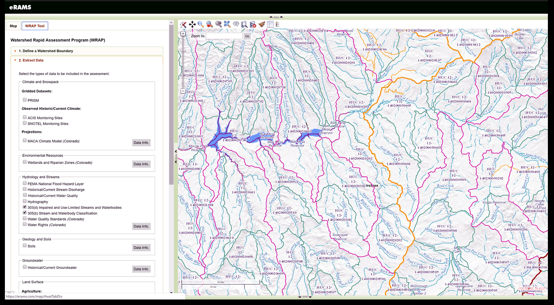
Watershed protection programs aim to maintain or restore the physical, chemical, and biological integrity of waterbodies. The development and implementation of these watershed plans require analysis of watershed conditions which are both spatially and temporally variable. Therefore, assessment of current and historic data and information is vital for continuously updating management plans in response to changing land use, climate, and watershed conditions. The Watershed Rapid Assessment Program (WRAP) is used to extract, organize, and analyze data and information at various watershed scales, including HUC 12, HUC 10, and HUC8 levels, for readily available geospatial characteristics as well as water quantity and quality. These characteristics include current and historic land use, population, climate, climate projections, stream discharge, and stream water quality to name a few. The integrated assessment of watershed health is then broken down into six primary attributes; landscape condition, habitat, hydrology, geomorphology, water quality, and biological condition. Utilizing the extracted data, the WRAP tool calculates a number of indicators for these attributes (e.g. median summer nitrate concentration as an indicator of water quality) to create an overall summary of the watershed condition. This overall condition can then be used at a state-wide scale to prioritize management actions of the state’s watersheds.
 eRAMS WRAP Watershed Conditions Assessment Tool.